
Issues With the State Complicate Wabanaki Co-Op Plans
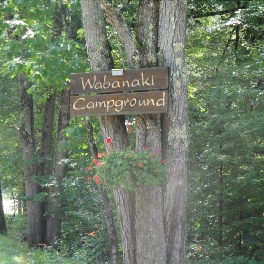
Freedom—March 20, 2025—Issues cited by state officials have created additional challenges for Wabanaki Campground’s plan to convert to a shareholder-owned cooperative.
Sixty-seven of the Freedom campground’s 77 property “units” have been reserved with down payments made by campers hoping to own a piece of the 11-acre Ossipee Lake property, according to Wabanaki’s website.
Before shares can be sold to the public, however, business owner/manager Mark Salvati must attest to the N.H. Consumer Protection and Antitrust Bureau that he is in compliance with all state and local regulations.
A Freedom Planning Board proceeding on proposed campground improvements, which has been ongoing for more than a year, was continued to April 17 after publication of a report concluding that the proceeding’s narrow focus was not sufficient to address the property’s environmental and zoning issues.
The report, by TND Engineering of Portsmouth, was sponsored by Ossipee Lake Alliance and abutting property owners Maureen and Dr. Anthony Raynes, and was endorsed by Freedom’s Conservation Commission, which said a “whole site” approach was needed.
The Planning Board has not publicly commented on the report. Campground owner Salvati said he is open to submitting a subdivision application and a stormwater management plan but has not provided a timeline for doing so.
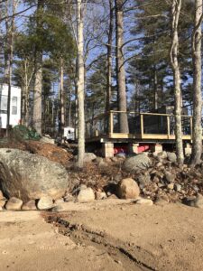
Meanwhile, the N.H. Department of Environmental Services opened a case file on the business after reviewing visuals of shoreline erosion and debris emptying into the lake from campground runoff. The agency is planning a spring inspection.
The damage to the shoreland and lake was reported to Freedom officials last April, but the responsibility for addressing it ping-ponged between the Select Board and the Planning Board for months without resolution.
DES has also opened a case file on unapproved decks and other structures inside the state’s 250-ft. shoreland buffer. “Protected vegetation” was also removed during construction, per the state’s complaint.
DES’s action came after former Zoning Officer Gary Wiliams, now a Selectman, responded to a Planning Board member’s complaint that unauthorized construction was taking place at the site.
Williams told the Planning Board he counted 23 zoning violations on the property, including 17 unapproved decks. His notes about his site visit state that he told Salvati the town was “just looking for newly built decks.”
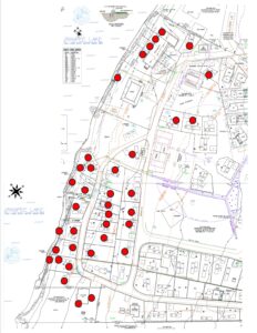
There are at least 63 decks on the property, none of which are approved, per town records. Freedom Zoning Officer Bryan Fontaine did not respond to a request to comment on the legal status of the 46 decks the town did not cite as zoning violations after the site visit.
DES told Ossipee Lake Alliance that any structure not shown in the permits it has on file for the property between 2000-2002 is not approved and “requires either a permit, if it meets current regulations, or removal if it is noncompliant.”
There are 37 decks inside the state’s protective setback, only four of which appear to be shown in the 2001-2002 documents. Those four decks are part of an “apartment building” that dates from years ago when the property was a children’s summer camp.
DES’s shoreland application process requires computing the percentage of impervious surfaces, which is a key metric in assessing whether proposed changes will require a professional stormwater management plan.
The state and town have different coverage thresholds for triggering the requirement, with the town’s being the more restrictive, at 25%.
DES said it received a Shoreland Permit Application from Salvati this week, asking for approval to replace “prior decks.”
“I have taken the position that because the majority of decks are replacements of prior decks, and any increase in impervious of “new” or “extended” surfaces decks is offset by the removal of the tennis court, there is no overall increase to the impervious area,” Salvati wrote.
Salvati said the percentage of impervious surfaces in the shoreland was 23%. Last May, DES approved a McConkey Construction Company septic system plan for the campground that stated the impervious surface coverage was 29.29%.
Salvati explained to DES that the McConkey Company’s computation contained a “fairly large error” in regard to the property’s roadway surfaces, causing him to reduce the calculation.
He added that he is “in the process of obtaining quotes” for a stormwater management plan as part of a subdivision filing with the town’s Planning Board.
Comments (0)