
Ossipee Lake is located in Carroll County in northeastern New Hampshire. At 3,245 acres, it is the sixth-largest lake located entirely in the state, and is surrounded by the towns of Ossipee, Freedom and Effingham.
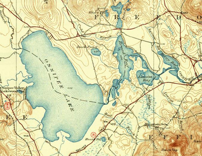 The lake is fed by the West Branch River from the north, the Bearcamp River and Lovell River from the west, and the Pine River from the south. Water leaves the eastern end of the lake at the Ossipee River and flows into the Saco River in Maine and on to the Atlantic Ocean.
Water Level
The Dam Bureau of the New Hampshire Department of Environmental Services maintains real-time information on Ossipee Lake’s water level, air temperature, and precipitation totals at Westward Shores and Ossipee River observation sites. Access this information by clicking here.
Deep Spots
If you’re curious about the depth and contour of the area’s lakes, ponds and bays, have a look at our collection of bathymetric maps from the N.H. Fish & Game Department.
Discover
Portions of Ossipee Lake remain undeveloped and are home to endangered animal species, rare plants and some of the finest remaining examples of rare habitats that once were common in the state. Check out our list of the special places that make Ossipee Lake one of the best lakes in New England.